Give the design context
Draw a point, line or boundary on the survey. Add the requirements and relevant project standards.
 TERRASCAN LABSAERIAL INTELLIGENCE
Explore earthwork concepts on your surveyed terrain with AI CAD in Terrascan Labs Platform, then hand the design to your engineering team.
Discuss your project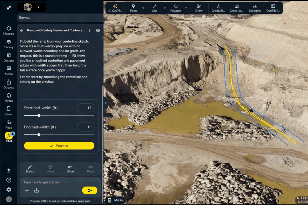
Draw a point, line or boundary on the survey. Add the requirements and relevant project standards.
Use a plain-language prompt to create a road, ramp, pad, trench or pond concept on your terrain.
Adjust dimensions, grades or boundaries and review how the proposal fits the existing surface.
Publish the concept as a design in Terrascan Labs Platform or export DXF/TTM for the next stage of review.
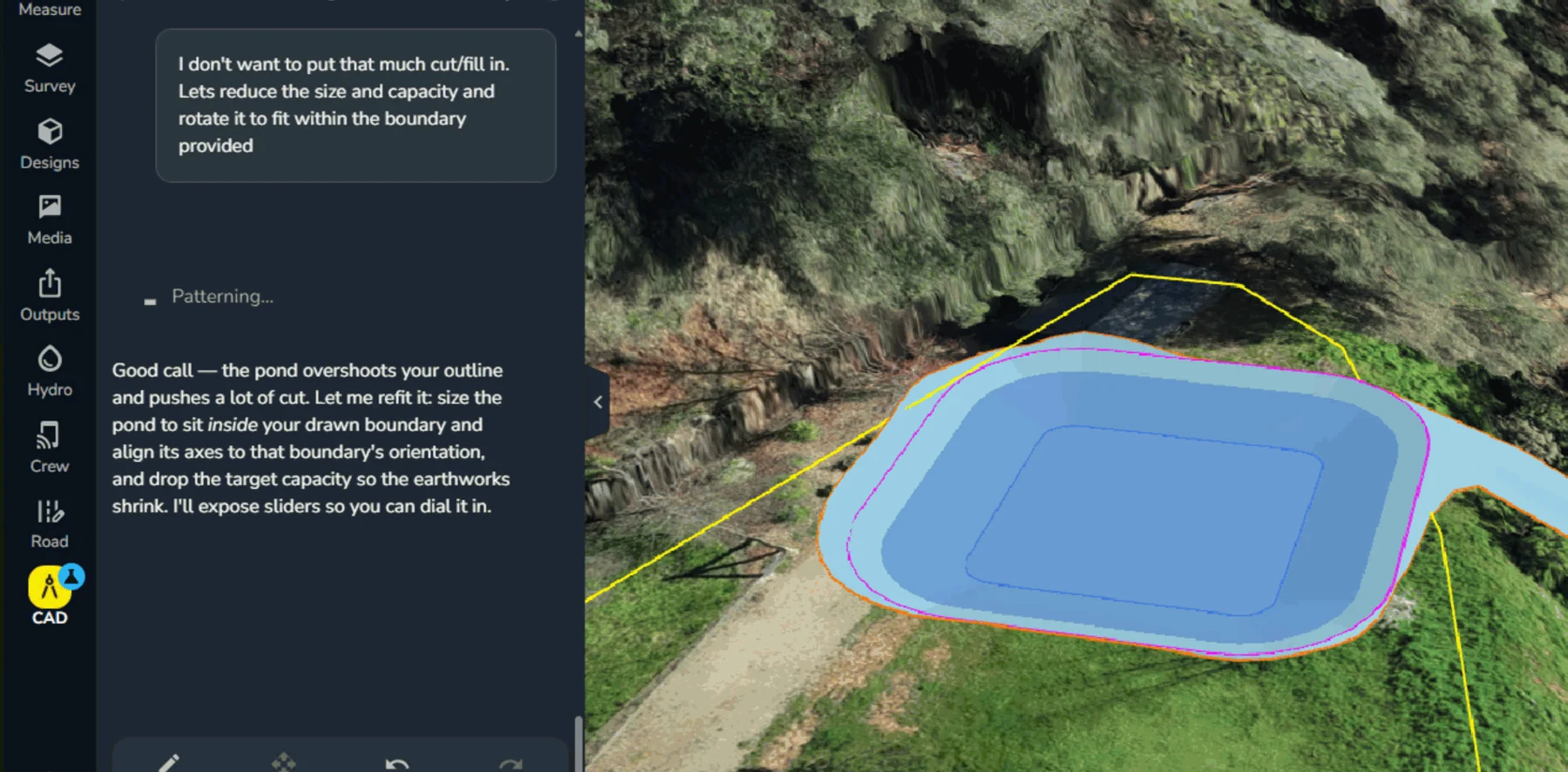
Terrascan prepares the survey foundation and helps your team establish the workflow. Use the concept to compare options and communicate intent, then take it into your engineering process for final design.
Tool availability depends on the project configuration and account permissions. We confirm access as part of the project scope.

Tell us what you need to measure, inspect, monitor or test. We’ll help define the right aerial approach.