Progress reviews
Record key work fronts at agreed intervals and preserve a visual history.
 TERRASCAN LABSAERIAL INTELLIGENCE
Connect panoramic views and field photography to the map, so every conversation starts with the right context.
Discuss your project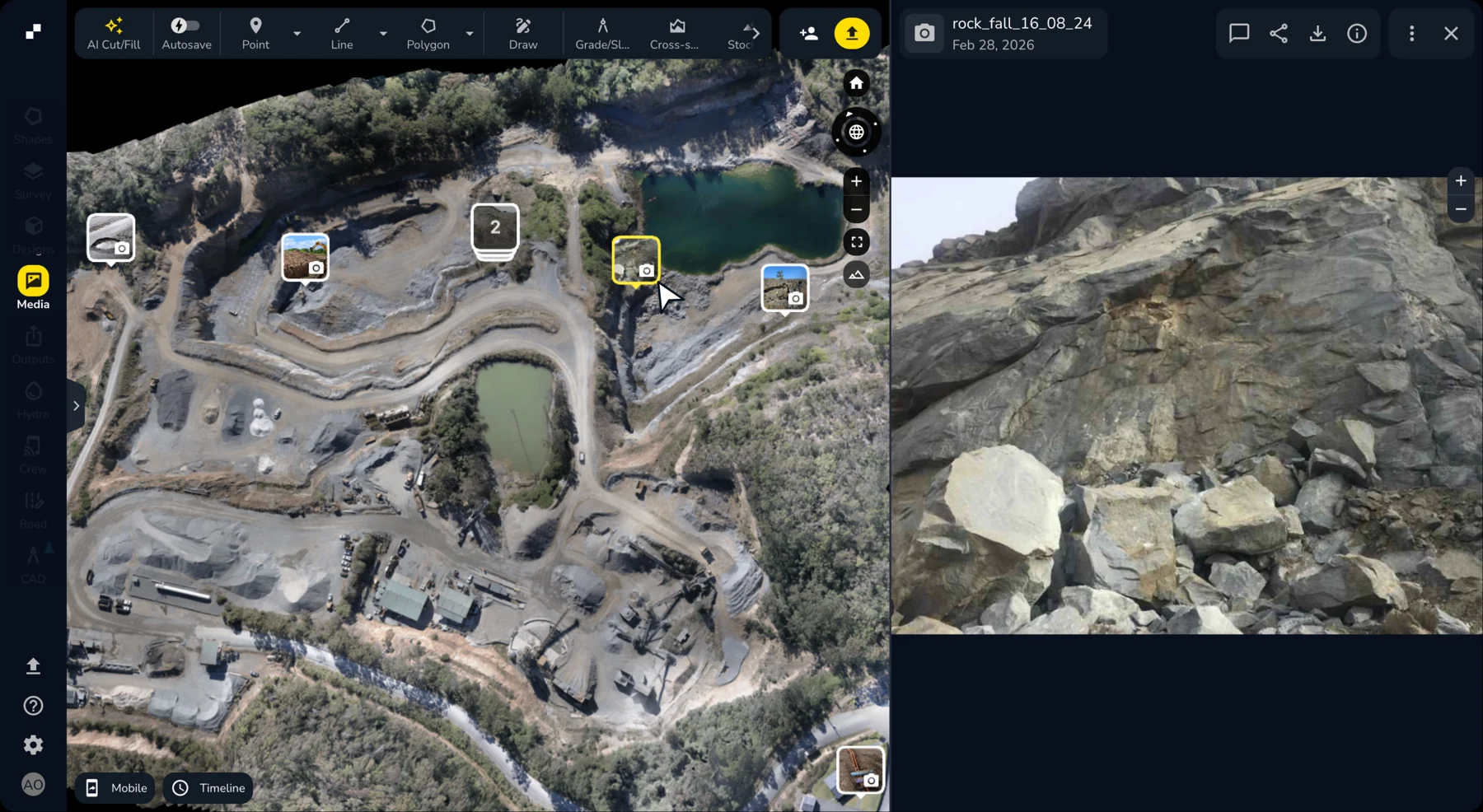
Terrascan Labs Platform brings site photos, 360° images and panoramas onto the project map. We capture the viewpoints that matter and organize them into a useful visual record for remote reviews.
Locate each image, review its date and discuss findings with the team. A split view keeps the photograph and its position visible together; date and category filters help you find the relevant visit.
Video demonstration coming soon
Preview placeholderRecord key work fronts at agreed intervals and preserve a visual history.
Give planners, supervisors and stakeholders a shared view before the next discussion.
Organize dated photographs and viewpoints alongside the project’s survey records.
Some advanced media and reporting tools in the platform require additional platform access. We define the included tools with your project scope.

Tell us what you need to measure, inspect, monitor or test. We’ll help define the right aerial approach.