360° virtual tours
Link panoramic views and field photographs to give remote teams the site context they need.
 TERRASCAN LABSAERIAL INTELLIGENCE
One partner for aerial surveying, site monitoring, advanced sensing and actionable insights. We build the complete service around your project—and put the results in your team’s hands.
From the desktop in the office to the phone in the field, explore your site, measure the work and share the same information. We handle capture, processing and delivery in Terrascan Labs Platform so your team can focus on the project.
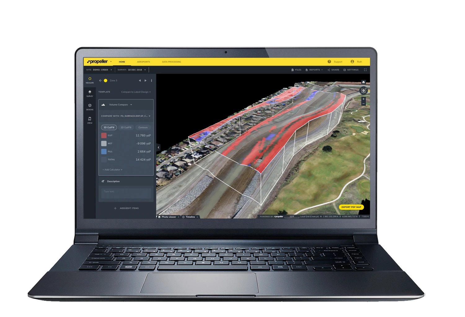
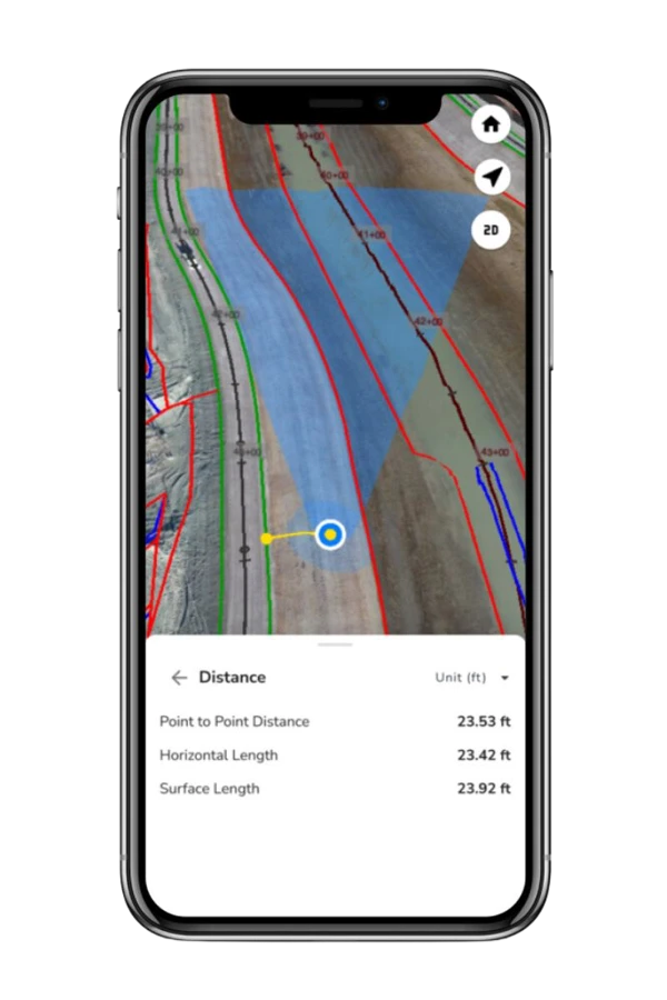
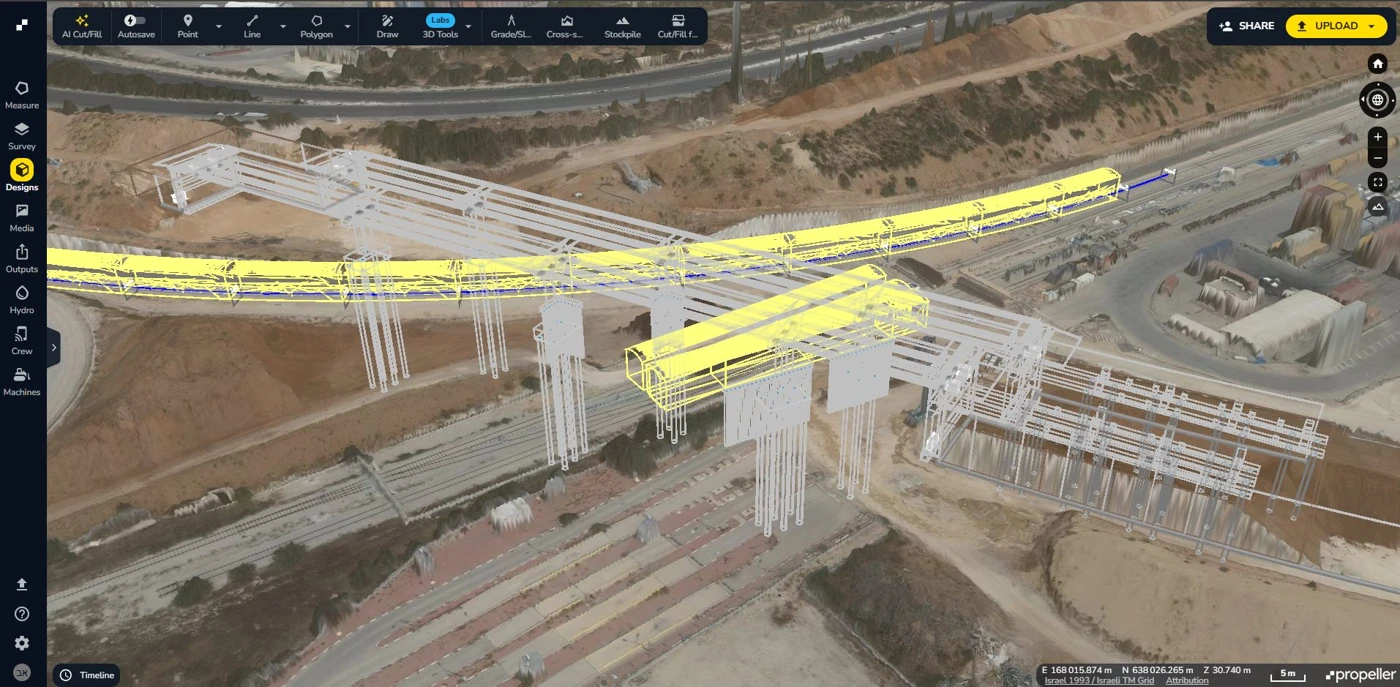
Review dated site surveys, inspect the bridge and its surroundings in 3D, and bring a shared visual record to every progress meeting.
Link panoramic views and field photographs to give remote teams the site context they need.
Turn measurements and progress records into repeatable reports for meetings, oversight and documentation.
Bring surveys, design files, annotations and 3D models into a common project workspace.
Working with the organizations building, operating and protecting Israel’s infrastructure.









Recurring surveys, a shared workspace in Terrascan Labs Platform and a clear record of what has changed on site.
Explore this service02Connect panoramic views and field photography to the map, so every conversation starts with the right context.
Explore this service03Explore earthwork concepts on your surveyed terrain with AI CAD in Terrascan Labs Platform, then hand the design to your engineering team.
Explore this service04Surveying, AI-assisted feature identification and structured reporting for infrastructure teams and municipalities.
Explore this service05Radiometric thermal surveys for solar assets, water networks and agricultural investigations.
Explore this serviceTerrascan Labs provides turnkey aerial intelligence: from planning and field capture to verified data, an accessible cloud workspace and the reports your team needs to act.
Nationwide coverage and recurring site visits
A single point of contact for field, data and delivery
Less time gathering information. More time using it.
Scope, accuracy, schedule and deliverables.
Licensed professionals and the right sensors.
Quality checks, mapping and secure cloud delivery.
Measurements, insights, reports and team onboarding.
Combine the services around your site, team and decisions. Each engagement has a defined scope, survey schedule and delivery format.
Scheduled aerial surveys make completed work, change and milestones visible. Compare dates and give project managers a consistent basis for progress reviews.
Ground control, processing and quality checks connect the survey to your required reference system. Measure distances, areas, stockpiles and cut-and-fill, with certified surveyor sign-off where required by the agreed scope.
Combine 360° photography, linked viewpoints and field photographs with aerial context. Teams can review conditions remotely and revisit a dated visual record.
Review design overlays, cross sections and elevations against the surveyed site. Locate differences and provide the evidence for engineering review and corrective action.
Configure recurring reporting around the project’s needs. Share measurements, annotated views and execution records in a cloud workspace so field, office and stakeholders work from the same data.
Deliver 3D meshes, point clouds and terrain models for planning, coordination and visualization. Match formats and reference systems to the receiving CAD, GIS and BIM workflow.
Combine LiDAR, radiometric thermal and multispectral sensing, including NIR and NDVI. Applications include surface indicators of underground water leaks, solar inspections and vegetation assessment, with focused field validation.
From custom platform configurations and sensor integration to prototypes and flight trials, our engineering and field teams help bring specialized UAV ideas into practical use.
Our municipal land-use and building reporting workflow combines orthophotos, parcel boundaries and analysis into a structured record for professional review.
The report moves from an executive summary and overview map to individual plot sheets: mapped land-use areas, building footprints and estimated heights, with source and quality notes. Tabular and GIS outputs allow the municipality to continue the work in its own systems.
Supports municipal review and property-tax assessment workflows. Classification and statutory decisions remain with the responsible professionals.
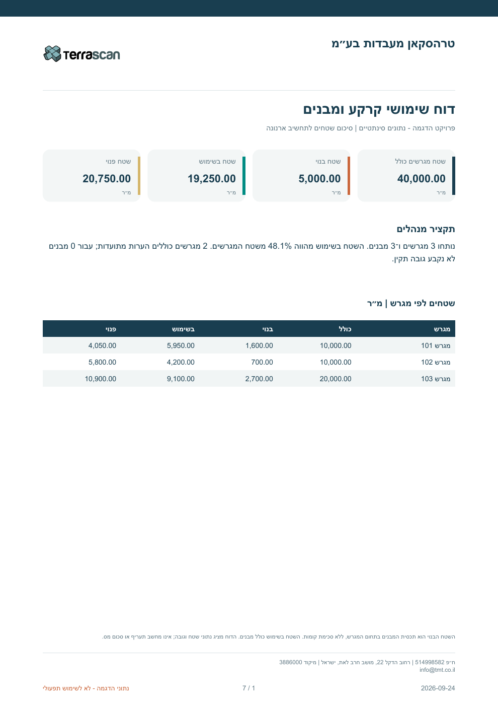
Demonstration using synthetic data from our reporting workflow. The figures are illustrative, not client results. Select the image to view it at full size.
Segmentation separates areas in imagery; identification locates individual assets and features. We combine model output with human review to produce useful, traceable records.
Workflow illustration: markers and records are illustrative, not actual detection results.

Tell us what you need to measure, inspect, monitor or test. We’ll help define the right aerial approach.